In brief
- NASA published the explanation in October 2026; the illustrated flight took place in November 2024.
- The airborne prototype still needs development before a space version.
A few lines do not tell the whole story
A map can look complete while leaving areas without direct measurements. On October 21, NASA explained how CASALS aims to reduce the gaps between observation tracks made by laser instruments used to study forests and terrain.
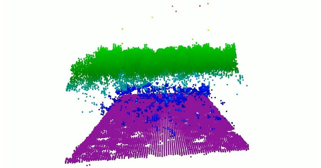
The goal is to collect continuous three-dimensional swaths rather than separate profiles. Think of measuring a room along only a few lines on the floor versus covering an entire strip. That is an illustration of the aim, not a technical equivalence between instruments.
The demonstration predates the announcement
The prototype flew in November 2024 aboard NASA’s B200 King Air aircraft. The visualization accompanying this article comes from a November 12 flight over Great Cypress Swamp in Delaware: green marks tree canopies, purple the ground and blue vegetation near the ground.
According to NASA, the instrument can resolve details at a horizontal resolution of 22 centimeters from roughly five kilometers above the surface. Instead of moving mirrors to steer each pulse, it uses changes in wavelength to direct light toward different positions.
The next steps still lie ahead
The team plans another airborne campaign for summer 2027. Before developing a space version, it wants to widen the measured swath and add onboard data processing. This is not a newly launched satellite or a feature you can switch on in a mapping app.
The development matters because a useful 3D representation depends on the measurements behind it. An impressive image and complete coverage are not the same thing: reducing unmeasured areas is precisely the problem this project is trying to solve.
Sources and context
Sources used for this article. Follow the links to read the original material.
See the linked sources for more information. Corrections and contact →