In brief
- Published October 26; observations come from September and October.
- The colors represent pigments and need context.
Autumn on a different scale
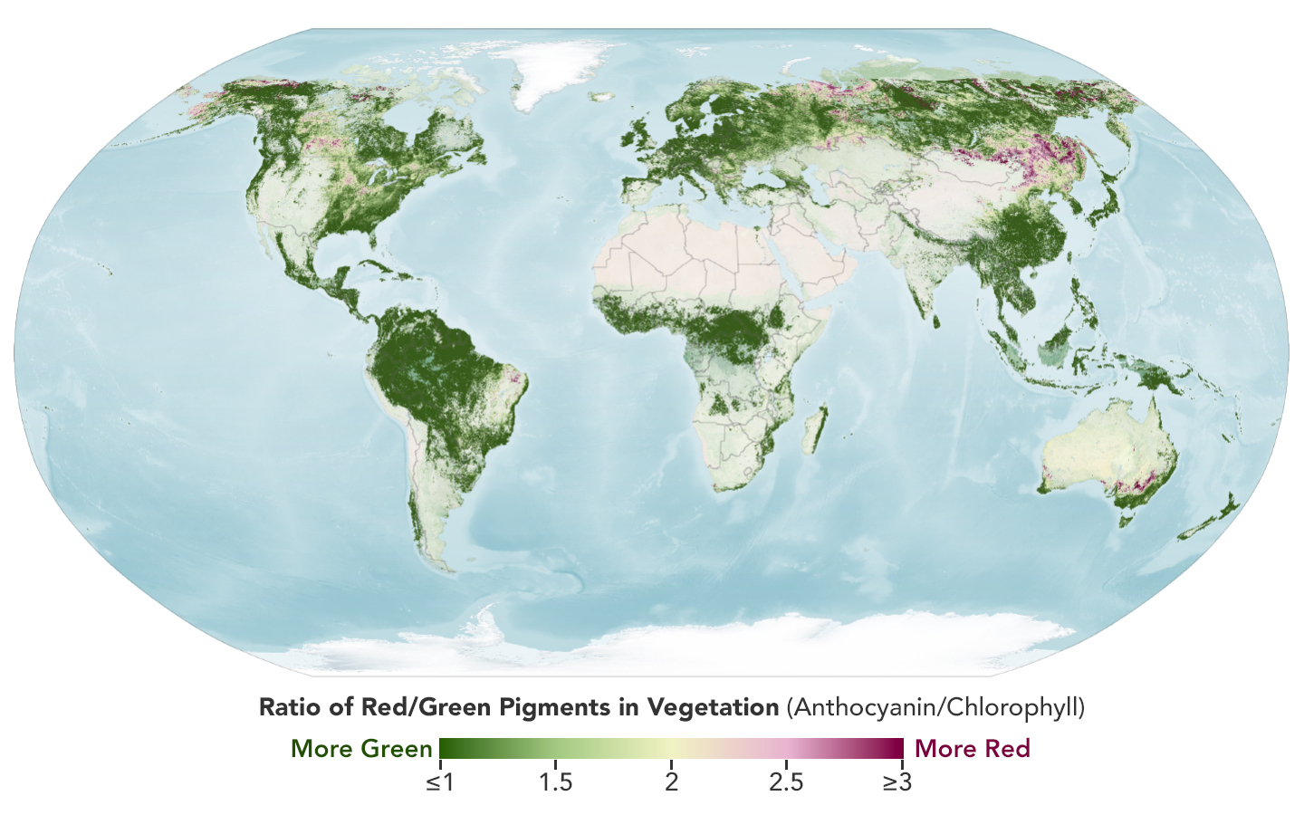
On October 26, 2026, NASA Earth Observatory published maps of vegetation color measured by PACE. They compare September 29–October 4 with October 5–11. The publication is new today; the observations are not.
The OCI instrument distinguishes many bands of light. This lets scientists study the balance between red and green plant pigments rather than simply judging whether a landscape looks yellower in a photograph.
Red does not always mean autumn leaves
The maps show the color shifting from one week to the next and reaching areas closer to the equator. Cropland also produces signals, however. Plant aging, drought and insect damage can play a role; clouds account for some gaps in coverage.
Read the scale before drawing conclusions. A high ratio of red to green does not, on its own, identify the best leaf-peeping destination or establish that every tree in an area is unhealthy.
Ground photos add another perspective
The PACE team is seeking vegetation photos to check the measurements through GLOBE’s North American phenology campaign. Shrubs, grasses and crops matter too, not just colorful forests. The linked source describes that campaign; this article is not announcing a separate Mexican initiative.
When comparing a map with your surroundings, start with the date and location. A park photograph taken weeks later may look beautiful, but it does not show the moment the satellite measured. That small check is useful both when planning an outing and when sharing a scientific image without overstating what it proves.
Sources and context
Sources used for this article. Follow the links to read the original material.
See the linked sources for more information. Corrections and contact →